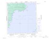
Maps showing Lonely Bay, Mackenzie, Northwest Territories
Lonely Bay is a Bay located in Mackenzie, Northwest Territories.
- Latitude: 61° 45' 1'' North (decimal: 61.7501628)
- Longitude: 115° 23' 5'' West (decimal: -115.3846049)
- Topography Feature Category: Bay
- Geographical Feature: Bay
- Canadian Province/Territory: Northwest Territories
- Location: Mackenzie
- Atlas of Canada Locator Map: Lonely Bay
- GPS Coordinate Locator Map: Lonely Bay Lat/Long
Lonely Bay NTS Map Sheets