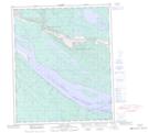
Maps showing Mac Island, Mackenzie, Northwest Territories
Mac Island is a Island located in Mackenzie, Northwest Territories and has an elevation of 56 meters.
- Latitude: 65° 16' 5'' North (decimal: 65.2681134)
- Longitude: 127° 4' 37'' West (decimal: -127.0768609)
- Topography Feature Category: Island
- Geographical Feature: Island
- Canadian Province/Territory: Northwest Territories
- Elevation: 56 meters
- Location: Mackenzie
- Atlas of Canada Locator Map: Mac Island
- GPS Coordinate Locator Map: Mac Island Lat/Long
Mac Island NTS Map Sheets