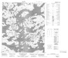
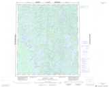
Maps showing MacQuade Island, Mackenzie, Northwest Territories
MacQuade Island is a Island located in Mackenzie, Northwest Territories.
- Latitude: 64° 42' 1'' North (decimal: 64.7002394)
- Longitude: 117° 44' 6'' West (decimal: -117.7348789)
- Topography Feature Category: Island
- Geographical Feature: Island
- Canadian Province/Territory: Northwest Territories
- Location: Mackenzie
- Atlas of Canada Locator Map: MacQuade Island
- GPS Coordinate Locator Map: MacQuade Island Lat/Long
MacQuade Island NTS Map Sheets