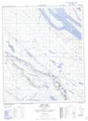
Maps showing Majel Lake, Mackenzie, Northwest Territories
Majel Lake is a Lake located in Mackenzie, Northwest Territories and has an elevation of 260 meters.
- Latitude: 65° 15' 10'' North (decimal: 65.2528345)
- Longitude: 127° 41' 17'' West (decimal: -127.6880077)
- Topography Feature Category: Lake
- Geographical Feature: Lake
- Canadian Province/Territory: Northwest Territories
- Elevation: 260 meters
- Location: Mackenzie
- Atlas of Canada Locator Map: Majel Lake
- GPS Coordinate Locator Map: Majel Lake Lat/Long
Majel Lake NTS Map Sheets