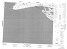
Maps showing Mary Sachs Creek, Franklin, Northwest Territories
Mary Sachs Creek is a River located in Franklin, Northwest Territories and has an elevation of 1 meters.
- Latitude: 71° 58' 21'' North (decimal: 71.9726129)
- Longitude: 125° 32' 31'' West (decimal: -125.5419061)
- Topography Feature Category: River
- Geographical Feature: Creek
- Canadian Province/Territory: Northwest Territories
- Elevation: 1 meters
- Location: Franklin
- Atlas of Canada Locator Map: Mary Sachs Creek
- GPS Coordinate Locator Map: Mary Sachs Creek Lat/Long
Mary Sachs Creek NTS Map Sheets