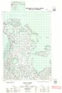
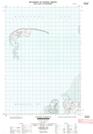
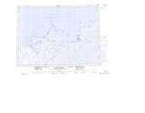
Maps showing Mason Bay, Franklin, Northwest Territories
Mason Bay is a Bay located in Franklin, Northwest Territories.
- Latitude: 69° 33' 00'' North (decimal: 69.5499592)
- Longitude: 134° 8' 10'' West (decimal: -134.1361310)
- Topography Feature Category: Bay
- Geographical Feature: Bay
- Canadian Province/Territory: Northwest Territories
- Location: Franklin
- Atlas of Canada Locator Map: Mason Bay
- GPS Coordinate Locator Map: Mason Bay Lat/Long
Mason Bay NTS Map Sheets