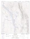
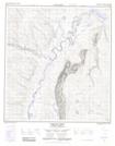
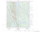
Maps showing Moose Pasture Creek, Mackenzie, Northwest Territories
Moose Pasture Creek is a River located in Mackenzie, Northwest Territories.
- Latitude: 63° 12' 30'' North (decimal: 63.2084245)
- Longitude: 123° 28' 31'' West (decimal: -123.4752486)
- Topography Feature Category: River
- Geographical Feature: Creek
- Canadian Province/Territory: Northwest Territories
- Location: Mackenzie
- Atlas of Canada Locator Map: Moose Pasture Creek
- GPS Coordinate Locator Map: Moose Pasture Creek Lat/Long
Moose Pasture Creek NTS Map Sheets