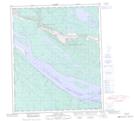
Maps showing Mount Morrow, Mackenzie, Northwest Territories
Mount Morrow is a Mountain located in Mackenzie, Northwest Territories and has an elevation of 215 meters.
- Latitude: 65° 28' 25'' North (decimal: 65.4736855)
- Longitude: 127° 24' 7'' West (decimal: -127.4019037)
- Topography Feature Category: Mountain
- Geographical Feature: Mount
- Canadian Province/Territory: Northwest Territories
- Elevation: 215 meters
- Location: Mackenzie
- Atlas of Canada Locator Map: Mount Morrow
- GPS Coordinate Locator Map: Mount Morrow Lat/Long
Mount Morrow NTS Map Sheets