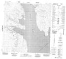
Maps showing Mould Bay, Franklin, Northwest Territories
Mould Bay is a Unincorporated area located in Franklin, Northwest Territories.
- Latitude: 76° 14' 2'' North (decimal: 76.2339816)
- Longitude: 119° 20' 12'' West (decimal: -119.3366278)
- Topography Feature Category: Unincorporated area
- Geographical Feature: Weather Station
- Canadian Province/Territory: Northwest Territories
- Location: Franklin
- Atlas of Canada Locator Map: Mould Bay
- GPS Coordinate Locator Map: Mould Bay Lat/Long
Mould Bay NTS Map Sheets