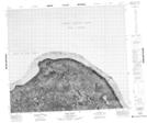
Maps showing Peel Point, Franklin, Northwest Territories
Peel Point is a Cape located in Franklin, Northwest Territories.
- Latitude: 73° 22' 2'' North (decimal: 73.3672665)
- Longitude: 114° 30' 8'' West (decimal: -114.5023442)
- Topography Feature Category: Cape
- Geographical Feature: Point
- Canadian Province/Territory: Northwest Territories
- Location: Franklin
- Atlas of Canada Locator Map: Peel Point
- GPS Coordinate Locator Map: Peel Point Lat/Long
Peel Point NTS Map Sheets