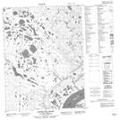
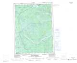
Maps showing Pointed Hill, Mackenzie, Northwest Territories
Pointed Hill is a Mountain located in Mackenzie, Northwest Territories and has an elevation of 218 meters.
- Latitude: 67° 21' 15'' North (decimal: 67.3541087)
- Longitude: 132° 32' 38'' West (decimal: -132.5439893)
- Topography Feature Category: Mountain
- Geographical Feature: Hill
- Canadian Province/Territory: Northwest Territories
- Elevation: 218 meters
- Location: Mackenzie
- Atlas of Canada Locator Map: Pointed Hill
- GPS Coordinate Locator Map: Pointed Hill Lat/Long
Pointed Hill NTS Map Sheets