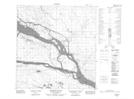
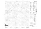
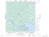
Maps showing Providence Rapids, Mackenzie, Northwest Territories
Providence Rapids is a Rapids located in Mackenzie, Northwest Territories and has an elevation of 155 meters.
- Latitude: 61° 18' 0'' North (decimal: 61.3001299)
- Longitude: 117° 36' 5'' West (decimal: -117.6013828)
- Topography Feature Category: Rapids
- Geographical Feature: Rapids
- Canadian Province/Territory: Northwest Territories
- Elevation: 155 meters
- Location: Mackenzie
- Atlas of Canada Locator Map: Providence Rapids
- GPS Coordinate Locator Map: Providence Rapids Lat/Long
Providence Rapids NTS Map Sheets