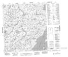
Maps showing Rat Lodge, Mackenzie, Northwest Territories
Rat Lodge is a Unincorporated area located in Mackenzie, Northwest Territories.
- Latitude: 63° 2' 1'' North (decimal: 63.0335870)
- Longitude: 108° 9' 3'' West (decimal: -108.1509110)
- Topography Feature Category: Unincorporated area
- Geographical Feature: Locality
- Canadian Province/Territory: Northwest Territories
- Location: Mackenzie
- GPS Coordinate Locator Map: Rat Lodge Lat/Long
Rat Lodge NTS Map Sheets