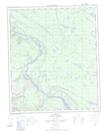
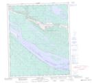
Maps showing Ray Creek, Mackenzie, Northwest Territories
Ray Creek is a River located in Mackenzie, Northwest Territories and has an elevation of 59 meters.
- Latitude: 65° 17' 5'' North (decimal: 65.2847826)
- Longitude: 127° 9' 57'' West (decimal: -127.1657566)
- Topography Feature Category: River
- Geographical Feature: Creek
- Canadian Province/Territory: Northwest Territories
- Elevation: 59 meters
- Location: Mackenzie
- Atlas of Canada Locator Map: Ray Creek
- GPS Coordinate Locator Map: Ray Creek Lat/Long
Ray Creek NTS Map Sheets