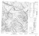
Maps showing Red Dog Mountain, Mackenzie, Northwest Territories
Red Dog Mountain is a Mountain located in Mackenzie, Northwest Territories and has an elevation of 456 meters.
- Latitude: 64° 12' 0'' North (decimal: 64.2000699)
- Longitude: 125° 39' 6'' West (decimal: -125.6517943)
- Topography Feature Category: Mountain
- Geographical Feature: Mountain
- Canadian Province/Territory: Northwest Territories
- Elevation: 456 meters
- Location: Mackenzie
- Atlas of Canada Locator Map: Red Dog Mountain
- GPS Coordinate Locator Map: Red Dog Mountain Lat/Long
Red Dog Mountain NTS Map Sheets