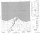
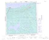
Maps showing Rudd Channel, Mackenzie, Northwest Territories
Rudd Channel is a Channel located in Mackenzie, Northwest Territories and has an elevation of 159 meters.
- Latitude: 60° 51' 0'' North (decimal: 60.8501275)
- Longitude: 115° 48' 5'' West (decimal: -115.8013632)
- Topography Feature Category: Channel
- Geographical Feature: Channel
- Canadian Province/Territory: Northwest Territories
- Elevation: 159 meters
- Location: Mackenzie
- Atlas of Canada Locator Map: Rudd Channel
- GPS Coordinate Locator Map: Rudd Channel Lat/Long
Rudd Channel NTS Map Sheets