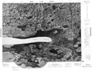
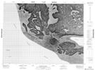
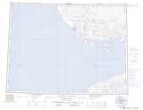
Maps showing Safety Channel, Franklin, Northwest Territories
Safety Channel is a Channel located in Franklin, Northwest Territories.
- Latitude: 70° 35' 2'' North (decimal: 70.5837805)
- Longitude: 116° 44' 8'' West (decimal: -116.7355468)
- Topography Feature Category: Channel
- Geographical Feature: Channel
- Canadian Province/Territory: Northwest Territories
- Location: Franklin
- Atlas of Canada Locator Map: Safety Channel
- GPS Coordinate Locator Map: Safety Channel Lat/Long
Safety Channel NTS Map Sheets