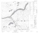
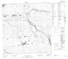
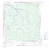
Maps showing Scotty Creek, Mackenzie, Northwest Territories
Scotty Creek is a River located in Mackenzie, Northwest Territories.
- Latitude: 61° 26' 10'' North (decimal: 61.4362033)
- Longitude: 121° 33' 35'' West (decimal: -121.5598332)
- Topography Feature Category: River
- Geographical Feature: Creek
- Canadian Province/Territory: Northwest Territories
- Location: Mackenzie
- Atlas of Canada Locator Map: Scotty Creek
- GPS Coordinate Locator Map: Scotty Creek Lat/Long
Scotty Creek NTS Map Sheets