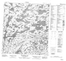
Maps showing Second Carp Portage, Mackenzie, Northwest Territories
Second Carp Portage is a Road feature located in Mackenzie, Northwest Territories and has an elevation of 349 meters.
- Latitude: 63° 39' 1'' North (decimal: 63.6502390)
- Longitude: 113° 45' 5'' West (decimal: -113.7512779)
- Topography Feature Category: Road feature
- Geographical Feature: Portage
- Canadian Province/Territory: Northwest Territories
- Elevation: 349 meters
- Location: Mackenzie
- Atlas of Canada Locator Map: Second Carp Portage
- GPS Coordinate Locator Map: Second Carp Portage Lat/Long
Second Carp Portage NTS Map Sheets