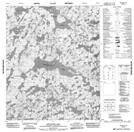
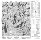
Maps showing Smoky Lake, Mackenzie, Northwest Territories
Smoky Lake is a Lake located in Mackenzie, Northwest Territories.
- Latitude: 65° 54' 1'' North (decimal: 65.9002865)
- Longitude: 116° 30' 6'' West (decimal: -116.5015354)
- Topography Feature Category: Lake
- Geographical Feature: Lake
- Canadian Province/Territory: Northwest Territories
- Location: Mackenzie
- Atlas of Canada Locator Map: Smoky Lake
- GPS Coordinate Locator Map: Smoky Lake Lat/Long
Smoky Lake NTS Map Sheets