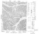
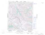
Maps showing Source Peaks, Mackenzie, Northwest Territories
Source Peaks is a Mountain located in Mackenzie, Northwest Territories and has an elevation of 1441 meters.
- Latitude: 64° 28' 00'' North (decimal: 64.4665777)
- Longitude: 130° 46' 7'' West (decimal: -130.7686426)
- Topography Feature Category: Mountain
- Geographical Feature: Peaks
- Canadian Province/Territory: Northwest Territories
- Elevation: 1441 meters
- Location: Mackenzie
- Atlas of Canada Locator Map: Source Peaks
- GPS Coordinate Locator Map: Source Peaks Lat/Long
Source Peaks NTS Map Sheets