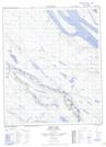
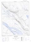
Maps showing Stanley Island, Mackenzie, Northwest Territories
Stanley Island is a Island located in Mackenzie, Northwest Territories and has an elevation of 56 meters.
- Latitude: 65° 29' 45'' North (decimal: 65.4959021)
- Longitude: 127° 40' 52'' West (decimal: -127.6810844)
- Topography Feature Category: Island
- Geographical Feature: Island
- Canadian Province/Territory: Northwest Territories
- Elevation: 56 meters
- Location: Mackenzie
- Atlas of Canada Locator Map: Stanley Island
- GPS Coordinate Locator Map: Stanley Island Lat/Long
Stanley Island NTS Map Sheets