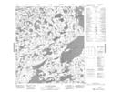
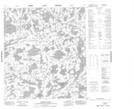
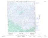
Maps showing Lac Tête d'Ours, Mackenzie, Northwest Territories
Lac Tête d'Ours is a Lake located in Mackenzie, Northwest Territories and has an elevation of 397 meters.
- Latitude: 63° 22' 0'' North (decimal: 63.3667920)
- Longitude: 110° 35' 3'' West (decimal: -110.5842793)
- Topography Feature Category: Lake
- Geographical Feature: Lake
- Canadian Province/Territory: Northwest Territories
- Elevation: 397 meters
- Location: Mackenzie
- Atlas of Canada Locator Map: Lac Tête d'Ours
- GPS Coordinate Locator Map: Lac Tête d'Ours Lat/Long
Lac Tête d'Ours NTS Map Sheets