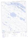
Maps showing Three Day Lake, Mackenzie, Northwest Territories
Three Day Lake is a Lake located in Mackenzie, Northwest Territories and has an elevation of 101 meters.
- Latitude: 65° 8' 30'' North (decimal: 65.1417304)
- Longitude: 126° 46' 7'' West (decimal: -126.7684927)
- Topography Feature Category: Lake
- Geographical Feature: Lake
- Canadian Province/Territory: Northwest Territories
- Elevation: 101 meters
- Location: Mackenzie
- Atlas of Canada Locator Map: Three Day Lake
- GPS Coordinate Locator Map: Three Day Lake Lat/Long
Three Day Lake NTS Map Sheets