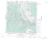
Maps showing Wrigley Creek, Mackenzie, Northwest Territories
Wrigley Creek is a River located in Mackenzie, Northwest Territories and has an elevation of 764 meters.
- Latitude: 61° 34' 00'' North (decimal: 61.5666309)
- Longitude: 125° 28' 6'' West (decimal: -125.4683442)
- Topography Feature Category: River
- Geographical Feature: Creek
- Canadian Province/Territory: Northwest Territories
- Elevation: 764 meters
- Location: Mackenzie
- Atlas of Canada Locator Map: Wrigley Creek
- GPS Coordinate Locator Map: Wrigley Creek Lat/Long
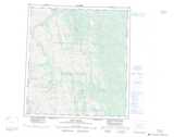
Wrigley Creek NTS Map Sheets