Canada Topographic Maps

Wrigley River Topo Maps

Topography maps and Latitude/Longitude Location

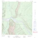
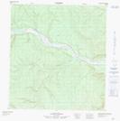
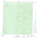
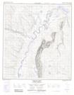
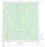
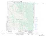
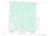
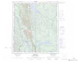
Maps showing Wrigley River, Mackenzie, Northwest Territories

Wrigley River is a River located in Mackenzie, Northwest Territories and has an elevation of 289 meters.

  • Latitude: 63° 14' 40'' North   (decimal: 63.2445340)
  • Longitude: 123° 35' 1'' West   (decimal: -123.5835895)
  • Topography Feature Category: River
  • Geographical Feature: River
  • Canadian Province/Territory: Northwest Territories
  • Elevation: 289 meters
  • Location: Mackenzie
  • Atlas of Canada Locator Map: Wrigley River
  • GPS Coordinate Locator Map: Wrigley River Lat/Long

Wrigley River NTS Map Sheets

095J13 No Title Topographic Map at 1:50,000 scale

095K16 No Title Topographic Map at 1:50,000 scale

095N01 No Title Topographic Map at 1:50,000 scale

095O04 Wrigley River Topographic Map at 1:50,000 scale

095J Camsell Bend Topographic Map at 1:250,000 scale

095K Root River Topographic Map at 1:250,000 scale

095N Dahadinni River Topographic Map at 1:250,000 scale

095O Wrigley Topographic Map at 1:250,000 scale

 
Buy Topographic Maps DVD
Newsletter Sign-up

Yes, I want to receive map store discounts.


Bookmark and Share