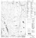
Maps showing Yatage River, Mackenzie, Northwest Territories
Yatage River is a River located in Mackenzie, Northwest Territories and has an elevation of 125 meters.
- Latitude: 67° 59' 0'' North (decimal: 67.9834089)
- Longitude: 129° 10' 8'' West (decimal: -129.1689911)
- Topography Feature Category: River
- Geographical Feature: River
- Canadian Province/Territory: Northwest Territories
- Elevation: 125 meters
- Location: Mackenzie
- Atlas of Canada Locator Map: Yatage River
- GPS Coordinate Locator Map: Yatage River Lat/Long
Yatage River NTS Map Sheets