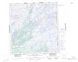
Maps showing Casimir Lake, Keewatin, Northwest Territories
Casimir Lake is a Lake located in Keewatin, Northwest Territories.
- Latitude: 61° 28' 21'' North (decimal: 61.4724691)
- Longitude: 102° 38' 22'' West (decimal: -102.6394283)
- Topography Feature Category: Lake
- Geographical Feature: Lake
- Canadian Province/Territory: Northwest Territories
- Location: Keewatin
- Atlas of Canada Locator Map: Casimir Lake
- GPS Coordinate Locator Map: Casimir Lake Lat/Long
Casimir Lake NTS Map Sheets