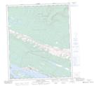
Maps showing Rayuka Island, Mackenzie, Northwest Territories
Rayuka Island is a Island located in Mackenzie, Northwest Territories and has an elevation of 54 meters.
- Latitude: 65° 16' 35'' North (decimal: 65.2764437)
- Longitude: 126° 52' 12'' West (decimal: -126.8699075)
- Topography Feature Category: Island
- Geographical Feature: Island
- Canadian Province/Territory: Northwest Territories
- Elevation: 54 meters
- Location: Mackenzie
- Atlas of Canada Locator Map: Rayuka Island
- GPS Coordinate Locator Map: Rayuka Island Lat/Long
Rayuka Island NTS Map Sheets