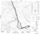
Maps showing Salt Plains 195, Mackenzie, Northwest Territories
Salt Plains 195 is a Indian Reserve located in Mackenzie, Northwest Territories.
- Latitude: 60° 6' 21'' North (decimal: 60.1057043)
- Longitude: 112° 14' 34'' West (decimal: -112.2427480)
- Topography Feature Category: Indian Reserve
- Geographical Feature: Indian Reserve - Réserve indienne
- Canadian Province/Territory: Northwest Territories
- Location: Mackenzie
- Atlas of Canada Locator Map: Salt Plains 195
- GPS Coordinate Locator Map: Salt Plains 195 Lat/Long
Salt Plains 195 NTS Map Sheets