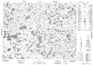
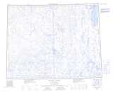
Maps showing Iqqakharvialuk, Northwest Territories
Iqqakharvialuk is a Lake located in Northwest Territories.
- Latitude: 71° 6' 2'' North (decimal: 71.1005238)
- Longitude: 111° 50' 7'' West (decimal: -111.835265)
- Topography Feature Category: Lake
- Geographical Feature: Lakes
- Canadian Province/Territory: Northwest Territories
- Atlas of Canada Locator Map: Iqqakharvialuk
- GPS Coordinate Locator Map: Iqqakharvialuk Lat/Long
Iqqakharvialuk NTS Map Sheets