Canada Topographic Maps

Pingualuuk Topo Maps

Topography maps and Latitude/Longitude Location

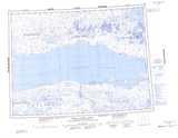
Maps showing Pingualuuk, Northwest Territories

Pingualuuk is a Mountain located in Northwest Territories.

  • Latitude: 70° 12' 2'' North   (decimal: 70.200454)
  • Longitude: 115° 20' 7'' West   (decimal: -115.335412)
  • Topography Feature Category: Mountain
  • Geographical Feature: Bluffs
  • Canadian Province/Territory: Northwest Territories
  • Atlas of Canada Locator Map: Pingualuuk
  • GPS Coordinate Locator Map: Pingualuuk Lat/Long

Pingualuuk NTS Map Sheets

087E03 No Title Topographic Map at 1:50,000 scale

087E04 No Title Topographic Map at 1:50,000 scale

087E05 No Title Topographic Map at 1:50,000 scale

087E06 No Title Topographic Map at 1:50,000 scale

087E Prince Albert Sound Topographic Map at 1:250,000 scale

 
Buy Topographic Maps DVD
Newsletter Sign-up

Yes, I want to receive map store discounts.


Bookmark and Share