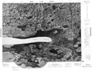
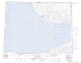
Maps showing Qayalihuk, Northwest Territories
Qayalihuk is a Lake located in Northwest Territories.
- Latitude: 70° 37' 32'' North (decimal: 70.6254528)
- Longitude: 116° 22' 53'' West (decimal: -116.3813575)
- Topography Feature Category: Lake
- Geographical Feature: Lake
- Canadian Province/Territory: Northwest Territories
- Atlas of Canada Locator Map: Qayalihuk
- GPS Coordinate Locator Map: Qayalihuk Lat/Long
Qayalihuk NTS Map Sheets