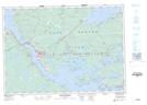
Maps showing Campbells Shoal, Undersea Features
Campbells Shoal is a Undersea feature located in Undersea Features.
- Latitude: 45° 30' North (decimal: 45.5000000)
- Longitude: 61° 1' West (decimal: -61.0166670)
- Topography Feature Category: Undersea feature
- Geographical Feature: Shoal - Haut-fond
- Canadian Province/Territory: Undersea Features
- Atlas of Canada Locator Map: Campbells Shoal
- GPS Coordinate Locator Map: Campbells Shoal Lat/Long
Campbells Shoal NTS Map Sheets