Maps showing Durands Rock, Undersea Features
Durands Rock is a Undersea feature located in Undersea Features.
- Latitude: 47° 34' North (decimal: 47.5666670)
- Longitude: 59° 13' West (decimal: -59.2166669)
- Topography Feature Category: Undersea feature
- Geographical Feature: Rock - Roche
- Canadian Province/Territory: Undersea Features
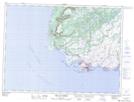
- Atlas of Canada Locator Map: Durands Rock
- GPS Coordinate Locator Map: Durands Rock Lat/Long
Durands Rock NTS Map Sheets