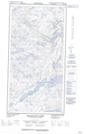
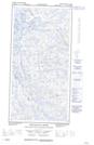
Maps showing Nuvualup Tasiujanga Bay, Nunavut
Nuvualup Tasiujanga Bay is a Bay located in Nunavut.
- Latitude: 60° 12' 53'' North (decimal: 60.2147000)
- Longitude: 64° 52' 20'' West (decimal: -64.8722000)
- Topography Feature Category: Bay
- Geographical Feature: Bay
- Canadian Province/Territory: Nunavut
- Atlas of Canada Locator Map: Nuvualup Tasiujanga Bay
- GPS Coordinate Locator Map: Nuvualup Tasiujanga Bay Lat/Long
Nuvualup Tasiujanga Bay NTS Map Sheets