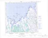
Maps showing Ikkarukutaaq Reef, Nunavut
Ikkarukutaaq Reef is a Shoal located in Nunavut.
- Latitude: 58° 32' 37'' North (decimal: 58.5435999)
- Longitude: 67° 41' 55'' West (decimal: -67.6985999)
- Topography Feature Category: Shoal
- Geographical Feature: Reef
- Canadian Province/Territory: Nunavut
- Atlas of Canada Locator Map: Ikkarukutaaq Reef
- GPS Coordinate Locator Map: Ikkarukutaaq Reef Lat/Long