Canada Topographic Maps

Péninsule Guindon Topo Maps

Topography maps and Latitude/Longitude Location

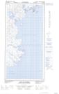
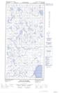
Maps showing Péninsule Guindon, Nunavut

Péninsule Guindon is a Cape located in Nunavut.

  • Latitude: 60° 43' 36'' North   (decimal: 60.7266999)
  • Longitude: 69° 33' 45'' West   (decimal: -69.5625000)
  • Topography Feature Category: Cape
  • Geographical Feature: Péninsule
  • Canadian Province/Territory: Nunavut
  • GPS Coordinate Locator Map: Péninsule Guindon Lat/Long

Péninsule Guindon NTS Map Sheets

025C12E Baie De Roziere Topographic Map at 1:50,000 scale

025C12W Baie De Roziere Topographic Map at 1:50,000 scale

025C Akpatok Island Topographic Map at 1:250,000 scale

 
Buy Topographic Maps DVD
Newsletter Sign-up

Yes, I want to receive map store discounts.


Bookmark and Share