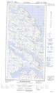
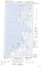
Maps showing Port Harvey, Nunavut
Port Harvey is a Marine navigation feature located in Nunavut and has an elevation of 3 meters.
- Latitude: 60° 29' 10'' North (decimal: 60.4861000)
- Longitude: 64° 40' 23'' West (decimal: -64.6730999)
- Topography Feature Category: Marine navigation feature
- Geographical Feature: Port
- Canadian Province/Territory: Nunavut
- Elevation: 3 meters
- Atlas of Canada Locator Map: Port Harvey
- GPS Coordinate Locator Map: Port Harvey Lat/Long
Port Harvey NTS Map Sheets