Canada Topographic Maps

Mosquito Bay Topo Maps

Topography maps and Latitude/Longitude Location

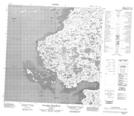
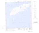
Maps showing Mosquito Bay, Nunavut

Mosquito Bay is a Bay located in Nunavut.

  • Latitude: 60° 44' 30'' North   (decimal: 60.7417000)
  • Longitude: 78° 4' 30'' West   (decimal: -78.0750000)
  • Topography Feature Category: Bay
  • Geographical Feature: Bay
  • Canadian Province/Territory: Nunavut
  • Atlas of Canada Locator Map: Mosquito Bay
  • GPS Coordinate Locator Map: Mosquito Bay Lat/Long

Mosquito Bay NTS Map Sheets

035C12 Collines Amajurjuk Topographic Map at 1:50,000 scale

035C13E Massif Kucyniak Topographic Map at 1:50,000 scale

035C13W Massif Kucyniak Topographic Map at 1:50,000 scale

035D10 Smith Island Topographic Map at 1:50,000 scale

035D16 Akulivik Topographic Map at 1:50,000 scale

035C Povungnituk Topographic Map at 1:250,000 scale

035D Map Not Available Topographic Map at 1:250,000 scale

 
Buy Topographic Maps DVD
Newsletter Sign-up

Yes, I want to receive map store discounts.


Bookmark and Share