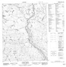
Maps showing Muskox Rapids, Nunavut
Muskox Rapids is a Lake located in Nunavut.
- Latitude: 67° 22' 55'' North (decimal: 67.3818999)
- Longitude: 115° 43' 15'' West (decimal: -115.7207999)
- Topography Feature Category: Lake
- Geographical Feature: Pond
- Canadian Province/Territory: Nunavut
- Atlas of Canada Locator Map: Muskox Rapids
- GPS Coordinate Locator Map: Muskox Rapids Lat/Long
Muskox Rapids NTS Map Sheets