Canada Topographic Maps

Nottingham Island Topo Maps

Topography maps and Latitude/Longitude Location

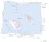
Maps showing Nottingham Island, Nunavut

Nottingham Island is a Island located in Nunavut.

  • Latitude: 63° 20' North   (decimal: 63.3333000)
  • Longitude: 77° 55' West   (decimal: -77.9167000)
  • Topography Feature Category: Island
  • Geographical Feature: Island
  • Canadian Province/Territory: Nunavut
  • Atlas of Canada Locator Map: Nottingham Island
  • GPS Coordinate Locator Map: Nottingham Island Lat/Long

Nottingham Island NTS Map Sheets

035M01 No Title Topographic Map at 1:50,000 scale

035M07 No Title Topographic Map at 1:50,000 scale

035M08 Fraser Island Topographic Map at 1:50,000 scale

035N04 Port De Boucherville Topographic Map at 1:50,000 scale

035N05 No Title Topographic Map at 1:50,000 scale

035N06 No Title Topographic Map at 1:50,000 scale

035N Nottingham Island Topographic Map at 1:250,000 scale

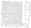
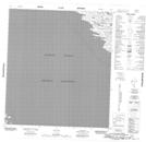
035M Map Not Available Topographic Map at 1:250,000 scale

 
Buy Topographic Maps DVD
Newsletter Sign-up

Yes, I want to receive map store discounts.


Bookmark and Share