Topographic Map Keys
In cartography, symbols are everything. The very nature of a map as an abstracted representation of the Earth requires symbols to perform the abstraction. To not have symbols is to not have maps.
When we first think of symbols, we tend to think of graphics representing elements that appear at points, like bridges and houses. Symbols can also be linear, representing such features as roads, railways and rivers. However, we also need to include representations of area, in the case of forested land or cleared land; this is done through the use of colour.
The set of symbols and their appropriate use on National Topographic System (NTS) maps is described by a specific set of rules: Standards and Specifications for Polychrome Maps. This guide ensures uniform depiction of land features on both 1/50 000 and 1/250 000 maps. However, like other forms of information, maps invariably undergo change. As an example, the fourth edition of a textbook will not have the same cover design or table of contents as the first edition. The information will be as reliable, but will have been reworked in certain places to reflect new findings or deliver the material in a more accessible fashion. In a similar way, changes are made to the symbols shown on NTS maps. Newer editions of 1/50 000 and 1/250 000 maps use symbols which look different from older NTS maps.
Download a two-page topographic map legend (PDF).
The most common map symbols are shown and defined in the following images:
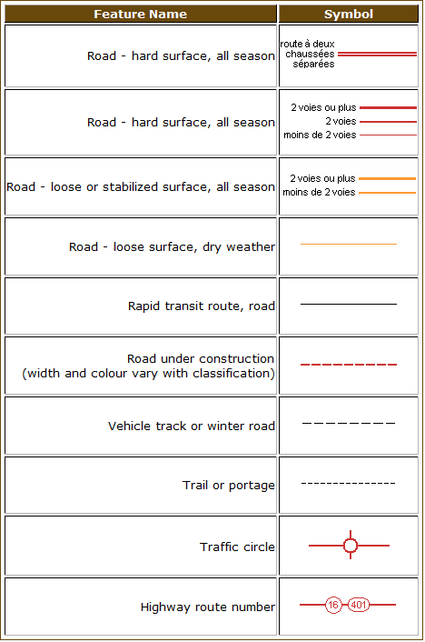
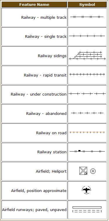
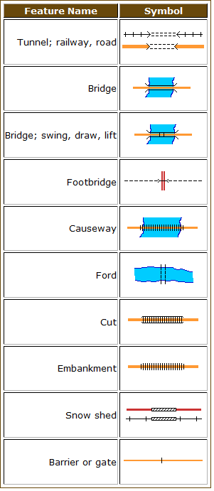
Transportation Features:
Roads and Trails
Railways and Airports
Other Transportation Features (tunnels, bridges, embankments, etc.)
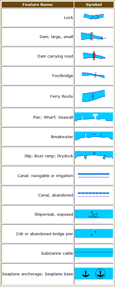
Hydrographic Features:
Man Made Hydrographic Features (docks, dams, canals, etc.)
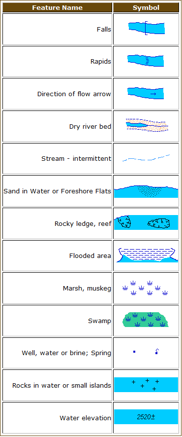
Naturally Occurring Hydrographic Features (falls, rapids, marsh, etc.)
Terrain Features:
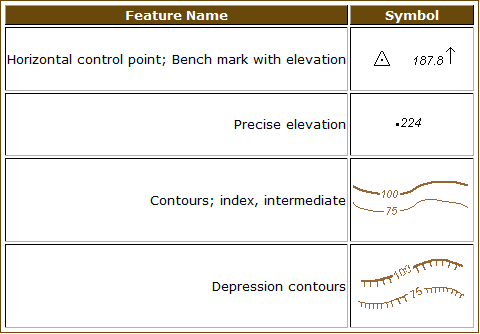
Elevation (contours, spot heights, etc.)
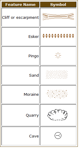
Geomorphology and Geology
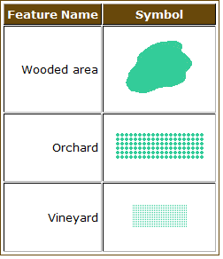
Land Cover
Human Activity Symbols:
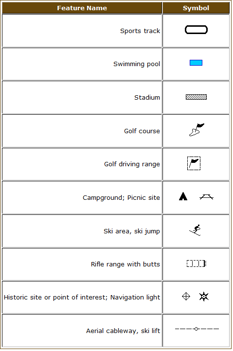
Recreation
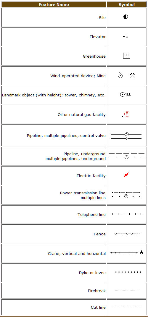
Agriculture and Industry
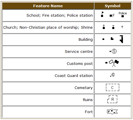
Buildings and Other Man-Made Features
Some categories of symbols on NTS maps include many different features. To let map users learn more about features in those categories, labels are used. A good example of how labels are helpful is with large buildings: a label will indicate which building is a hospital and which is a skating rink.