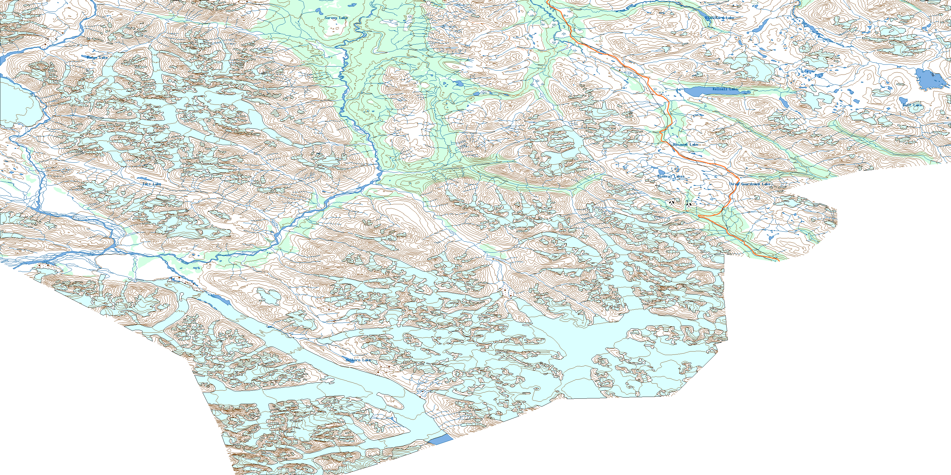
Tatshenshini River Topo Map
Free Topo Maps Downloadable Online: 114P
114P Tatshenshini River Topo Map
To view this map, mouse over the map preview on the right.
You can also download this topo map for free:
114P Tatshenshini River high-resolution topo map image.
Maps for the Tatshenshini River map sheet 114P at 1:250,000 scale are also available in these 4 versions:
Tatshenshini River Surrounding Area Topos (NTS 114)
 |
 |
||
© Department of Natural Resources Canada. All rights reserved.
114P Tatshenshini River Area Topo Maps at 1:50,000
 |
 |
 |
 |
 |
 |
 |
 |
 |
 |
 |
 |
 |
© Department of Natural Resources Canada. All rights reserved.
© Department of Natural Resources Canada. All rights reserved.
114P Related Maps:
114P Tatshenshini River114P02 Carroll Glacier
114P03 Grand Pacific Glacier
114P04 Mount Lodge
114P05 Konamoxt Glacier
114P06 Pentice Ridge
114P07 Tsirku Glacier
114P08 Mount Henry Clay
114P09 Kelsall River
114P10 Nadahini Creek
114P11 Carmine Mountain
114P12 Tats Lake
114P13 Range Lake
114P14 Survey Lake
114P15 Parton River
114P16 Mount Kelsall
