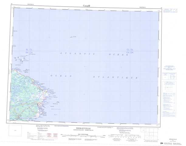
Canada Topo Maps 002f WESLEYVILLE: Preview

Zoom in: WESLEYVILLE Topo Map
 

002f WESLEYVILLE - Canada Topo Map

National Topographic System of Canada (NTS): 002f WESLEYVILLE
Georeferenced at 1:250,000 scale - WESLEYVILLE topo map in JPEG format.
  Buy Canada Topo Maps on DVD


WESLEYVILLE Topo Maps at 1:50,000:
002f03   CABOT ISLANDS
002f04   WESLEYVILLE
002f05   MUSGRAVE HARBOUR
002f12   WADHAM ISLANDS
  002f WESLEYVILLE Topo Map - National Topographic System of Canada (NTS) - CanMaps.com
  © Department of Natural Resources Canada. All rights reserved.
002f WESLEYVILLE - Canadian Topographical Map at 1:250,000 scale. National Topographic System of Canada (NTS).


Canada Topo Maps        US Maps        Find Maps        Buy Canada Topo Maps DVD        Contact
Use of this website signifies your agreement to the Terms of Use & Privacy Policy.
Copyright © 2009 YellowMaps. All rights reserved. Web Design by YellowMaps.