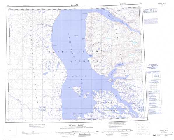
048B Moffet Inlet Topographic Maps
Maps for the Moffet Inlet map sheet 048B at 1:250,000 scale are available in 5 versions:
Topographic Map of Moffet Inlet
1:50,000 Scale Topos for Moffet Inlet 048B:
 |
 |
||
 |
 |
||
 |
 |
||
048B Related Maps:
048B Moffet Inlet
048B07 Red Valley
048B08 Fabricius Fiord
048B09 Mount Podolsky
048B10 Levasseur Inlet
048B15 Cape Cunningham
048B16 Adams Sound
048B07 Red Valley
048B08 Fabricius Fiord
048B09 Mount Podolsky
048B10 Levasseur Inlet
048B15 Cape Cunningham
048B16 Adams Sound
