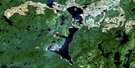
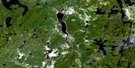
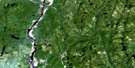
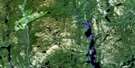
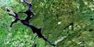
Lac A L'Eau Doree Satellite Image Map
Download Free Aerial Photo 022J16 at 1:50,000 scale
Lac A L'Eau Doree Satellite Imagery
To view this satellite map, mouse over the air photo on the right.
You can also download this satellite image map for free:
022J16 Lac A L'Eau Doree high-resolution satellite image map.
Maps for the Lac A L'Eau Doree aerial map sheet 022J16 at 1:50,000 scale are also available in these versions:
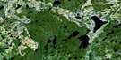
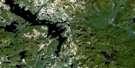
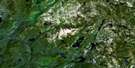
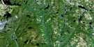
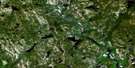
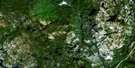
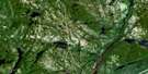
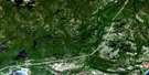
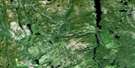
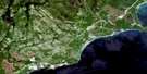
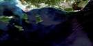
Lac A L'Eau Doree Surrounding Area Aerial Photo Maps
 |
 |
 |
 |
 |
 |
 |
 |
 |
 |
 |
 |
 |
 |
 |
 |
© Department of Natural Resources Canada. All rights reserved.
Lac A L'Eau Doree Gazetteer
The following places can be found on satellite image map 022J16 Lac A L'Eau Doree:
Lac A L'Eau Doree Satellite Image: Islands
Île à Jean-PaulLac A L'Eau Doree Satellite Image: Lakes
Lac à l'Eau DoréeLac Bérubé
Lac Delamarre
Lac du Castor
Lac Gagné
Lac Kakatiak
Lac Régis
Lac Tremblay
Lac Vigneau
Lac Villebois
Lac A L'Eau Doree Satellite Image: Rapids
Rapides de la Bête PuanteRapides Joseph
Lac A L'Eau Doree Satellite Image: Rivers
Rivière à l'Eau DoréeRivière Joseph
Rivière Kakatiak
Rivière Moisie
Rivière Nipissis
Rivière Ouapetec
Ruisseau de la Bête Puante
Ruisseau la Truite
Lac A L'Eau Doree Satellite Image: River features
Fosse de la Grande ViréeFosse de l'Explorateur
Fosse du Coude
Fosse Ouapetec
Lac A L'Eau Doree Satellite Image: Road features
Portage des Rapides-JosephLac A L'Eau Doree Satellite Image: Shoals
Fosse des Guides
© Department of Natural Resources Canada. All rights reserved.
022J Related Maps:
022J Sept-Iles022J01 Sept-Iles
022J02 Clarke City
022J03 Lac Quatre Lieues
022J04 Lac Sainte-Anne
022J05 Lac Beaudin
022J06 Lac Walker
022J07 Lac Asquiche
022J08 Lac Des Rapides
022J09 Riviere Vallee
022J10 Lac Attacaupe
022J11 Lac Rond
022J12 Lac Bouffard
022J13 Lac Fortin
022J14 Grand Lac Du Nord
022J15 Lac Dollard
022J16 Lac A L'Eau Doree
