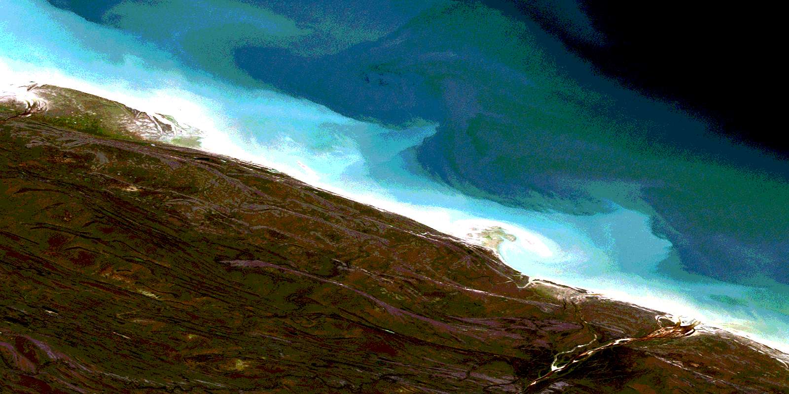
Pemichiwunatapo Creek Satellite Image Map
Download Free Aerial Photo 054G01 at 1:50,000 scale
Pemichiwunatapo Creek Satellite Imagery
To view this satellite map, mouse over the air photo on the right.
You can also download this satellite image map for free:
054G01 Pemichiwunatapo Creek high-resolution satellite image map.
Maps for the Pemichiwunatapo Creek aerial map sheet 054G01 at 1:50,000 scale are also available in these versions:
Pemichiwunatapo Creek Surrounding Area Aerial Photo Maps
 |
|||
 |
 |
 |
 |
© Department of Natural Resources Canada. All rights reserved.
Pemichiwunatapo Creek Gazetteer
The following places can be found on satellite image map 054G01 Pemichiwunatapo Creek:
Pemichiwunatapo Creek Satellite Image: Islands
Anabusko IslandPemichiwunatapo Creek Satellite Image: Conservation areas
Cape Tatnam Wildlife Management AreaPemichiwunatapo Creek Satellite Image: Rivers
Anabusko RiverKaskattama River
Kichekokotik River
Pechepikwan Creek
Pemichiwunatapo Creek
© Department of Natural Resources Canada. All rights reserved.
