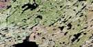
Dutton Lake Satellite Image Map
Download Free Aerial Photo 064M09 at 1:50,000 scale
Dutton Lake Satellite Imagery
To view this satellite map, mouse over the air photo on the right.
You can also download this satellite image map for free:
064M09 Dutton Lake high-resolution satellite image map.
Maps for the Dutton Lake aerial map sheet 064M09 at 1:50,000 scale are also available in these versions:
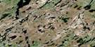
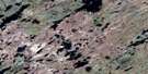
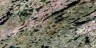
Dutton Lake Surrounding Area Aerial Photo Maps
 |
 |
 |
 |
 |
 |
 |
 |
 |
 |
 |
 |
 |
 |
 |
 |
© Department of Natural Resources Canada. All rights reserved.
Dutton Lake Gazetteer
The following places can be found on satellite image map 064M09 Dutton Lake:
Dutton Lake Satellite Image: Bays
Archibald BayFlavelle Bay
Pott Bay
Dutton Lake Satellite Image: Capes
Anderson PeninsulaDutton Lake Satellite Image: Islands
Stinson IslandDutton Lake Satellite Image: Lakes
Aniska LakeAniska Lake
Apipuyew Lake
Chekask Lake
Chekask Lake
Chobaniuk Lake
Davies Lake
Dutton Lake
Evans Lake
Flynn Lake
Gay Lake
Grabowski Lakes
Grabowski Lakes
Green Lake
Hornfelt Lake
Kittelson Lake
Kreisch Lake
Many Islands Lake
McIntyre Lake
Nunim Lake
Spratt Lake
Dutton Lake Satellite Image: Provinces
ManitobaSaskatchewan
Dutton Lake Satellite Image: Rivers
Peterson CreekSchwandt River
© Department of Natural Resources Canada. All rights reserved.
064M Related Maps:
064M Phelps Lake064M01 Hara Lake
064M02 Eyinew Lake
064M03 Bickerton Lake
064M04 Misekumaw Lake
064M05 Mukasew Lake
064M06 Franklin Lake
064M07 Hutcherson Lake
064M08 Nunim Lake
064M09 Dutton Lake
064M10 Emerson Lake
064M11 Battleford Lake
064M12 Sakwasew Lake
064M13 Wayow Lake
064M14 Gebhard Lake
064M15 Warren Lake
064M16 Patterson Lake
