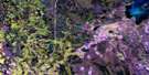
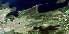
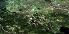
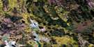
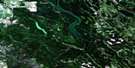
Sled Lake Satellite Image Map
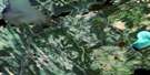
Download Free Aerial Photo 073J06 at 1:50,000 scale
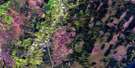
Sled Lake Satellite Imagery
To view this satellite map, mouse over the air photo on the right.
You can also download this satellite image map for free:
073J06 Sled Lake high-resolution satellite image map.
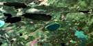
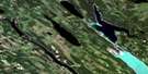
Maps for the Sled Lake aerial map sheet 073J06 at 1:50,000 scale are also available in these versions:
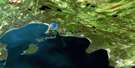
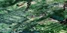
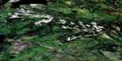
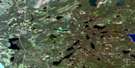
Sled Lake Surrounding Area Aerial Photo Maps
 |
 |
 |
 |
 |
 |
 |
 |
 |
 |
 |
 |
 |
 |
 |
 |
© Department of Natural Resources Canada. All rights reserved.
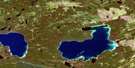
Sled Lake Gazetteer
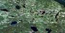
The following places can be found on satellite image map 073J06 Sled Lake:
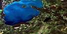
Sled Lake Satellite Image: Bays
Appleby BayKoepke Bay
Matheson Bay
Toth Bay
Sled Lake Satellite Image: Hamlets
Sled LakeSled Lake Satellite Image: Lakes
Abel LakeAppleby Lake
Beaupré Lake
Blackrat Lake
Brother Lakes
Clarke Lake
Hunting Lake
Lawrence Lake
Little Sled Lake
Mirasty Lake
Shirley Lake
Sled Lake
Threemile Lake
Sled Lake Satellite Image: Conservation areas
Shirley Lake Recreation SiteSled Lake Satellite Image: Rivers
Appleby CreekBeaupré Creek
Cowan River
Pace Creek
Taggart Creek

© Department of Natural Resources Canada. All rights reserved.
073J Related Maps:
073J Green Lake073J01 Crean Lake
073J02 Strange Lake
073J03 Taggart Lake
073J04 Green Lake South
073J05 Green Lake
073J06 Sled Lake
073J07 Listen Lake
073J08 Musquash Lake
073J09 Randall Lake
073J10 Smoothstone Lake
073J11 Dore Lake
073J12 Bazill Bay
073J13 Durocher Lake
073J14 Northern Bay
073J15 Swan Lakes
073J16 Twoforks River
